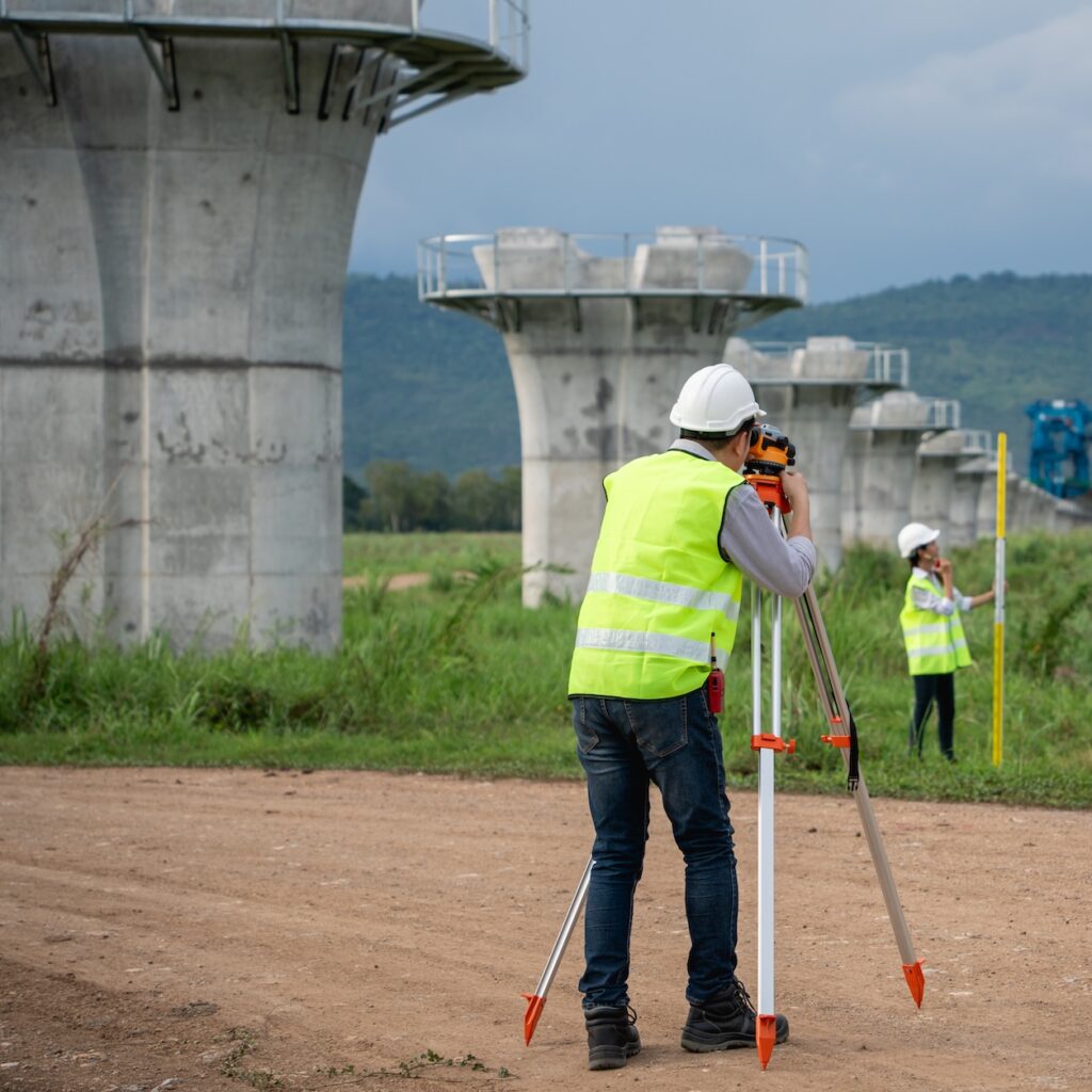

Land Survey & Mapping
We are carrying out land survey and mapping. As an
example,
1. Topographical Survey
2. Boundary Line Demarcation
3. Plot Surveying before excavation and original ground level after earth cutting for volumecalculation.
1. Topographical Survey
2. Boundary Line Demarcation
3. Plot Surveying before excavation and original ground level after earth cutting for volumecalculation.

Physical Stock Verification
Physical stock verification is the process of counting and reconciling actual inventory with recorded stock levels. It ensures accuracy, prevents discrepancies, and helps maintain proper inventory management and financial reporting.

Contour Survey
A contour survey maps land elevations, showing natural and man-made features. It helps in construction, drainage, and planning by illustrating slopes, contours, and terrain variations for accurate site development and design.

Route Survey
A route survey analyzes and maps the best path for transportation or utility projects. It includes terrain evaluation, alignment planning, and obstacle identification for roads, pipelines, railways, and other infrastructure developments.

Mining Survey
A mining survey assesses and maps mineral deposits, mine boundaries, and underground or surface features. It ensures safe excavation, resource estimation, and compliance with regulations for efficient and sustainable mining operations.

Engineering Survey
An engineering survey collects and analyzes land data for construction projects. It includes topographic, boundary, and structural assessments to ensure precise planning, design, and execution of infrastructure, buildings, and utilities.

2D & 3D Plan of Building Construction
2D and 3D building plans provide detailed architectural and structural layouts for construction. 2D plans show floor layouts, dimensions, and elevations, while 3D plans offer realistic visualizations for better design understanding and project execution.

Physical stock inventory of Silos
Physical stock inventory of silos involves measuring and verifying the actual quantity of stored materials, such as grains or cement, against recorded data. It ensures accuracy, prevents losses, and aids in inventory management.